ALPHA TELECOMThailand edition

Vietnam

Exchange and money · Vietnamese dong · VND

  • The State Bank identifies the local monetary unit as the dong, abbreviated VND. Keep a modest reserve in smaller notes for the chosen arrival journey and incidental spending; request suitable denominations when exchanging.

    State Bank of Vietnam: Vietnamese Currency
  • Prefer a bank counter or an exchange office that can show authorization. Ask whether it buys your actual currency and notes. Vietcombank distinguishes cash buying, telegraphic buying and selling; compare the applicable cash-buying offer when exchanging foreign banknotes for dong.

    Vietcombank: exchange-rate categories and reference-only notice
  • Ask for the net dong amount after fees before handing over money; count it at the counter and retain the receipt. A bank reference page is not a live transaction quote or proof that RUB notes are accepted at a particular branch.

    Vietcombank: exchange-rate categories and reference-only notice
  • The State Bank identifies dong notes and coins as legal tender. Ask the chosen driver or transfer operator whether cash is accepted, in which currency and on what price basis before treating it as a fallback. Check any card separately with its issuer and the merchant; Russian-card compatibility and ATM success are unverified.

    State Bank of Vietnam: Vietnamese Currency

Taxi preparation

  • If your transfer is already booked, follow its meeting instructions instead of buying an unnecessary replacement. Da Nang airport directs coach passengers to their guide and offers the information desk as a recovery point if separated.

    Da Nang International Airport: transport from the airport
  • Da Nang airport lists staffed taxi stands and route fare charts. Check the chart or ask assisting staff; for another taxi, clarify meter versus agreed route price, airport charges, tolls and waiting before departure. Do not treat a city-centre fare as a Hoi An fare.

    Da Nang International Airport: transport from the airport
  • For either base, ask the hotel or arranging operator before departure whether it can confirm a car, meeting instructions, luggage capacity and payment. Hotel-assisted availability is unverified. Treat an app ride only as an optional, unverified choice if your account, phone and payment work for that journey; keep the confirmed transfer as the primary plan when already booked.

    Da Nang International Airport: transport from the airport
  • Save your airline’s terminal details and confirmed transfer instructions, then follow current signs and match the vehicle and driver before boarding. Da Nang airport offers information-desk help for separated coach passengers. If you need another car, ask staff or your hotel for assistance and obtain confirmation; no Cam Ranh staffed facility or exact pickup position is verified here.

    Da Nang International Airport: transport from the airport

Phone and arrival

Vietnam

Cam Ranh arrival and Nha Trang coastal base

A suggested airport-to-city arrival spine for a coastal stay. Confirm the real hotel address before arranging a road transfer; the city point is not every resort.

Suggested trip, not a popularity ranking or a verified transport service. The retained tourism-authority description supports Nha Trang as a coastal destination; archived airport and city coordinates support geographic orientation only. Ask the arranging operator to confirm the actual transfer.
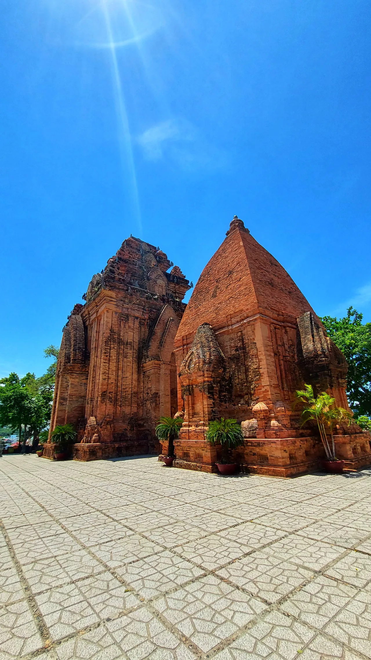
Red-brick towers and a paved courtyard at Po Nagar Temple in Nha Trang, Vietnam
Po Nagar Temple, Nha Trang, Vietnam. Photo by Jose Varghese, CC0, from the WordPress Photo Directory. Resized and WebP-optimized; original composition preserved. Photo: Jose Varghese · CC0 · Original source

Dashed overview legs: not road geometry, a ferry timetable or turn-by-turn directions.

Stops in order

  1. Cam Ranh International Airport

    Airport reference point, not a terminal pickup bay. Use the terminal and meeting instructions for your confirmed transfer or selected provider.

    11.998055555556, 109.21944444444 · airport reference point · Wikidata: Cam Ranh airport reference point (CC0 structured data)

  2. Nha Trang city reference point

    City reference only. Replace it with the accommodation’s real address when asking for a car; a coastal resort is not automatically at this marker.

    12.245, 109.19166666666666 · city-centre reference · Wikidata: Nha Trang city reference point (CC0 structured data)

Transport choices

  1. Cam Ranh International Airport → Nha Trang city reference point · Road

    If arriving at Cam Ranh for a Nha Trang stay, keep an already-confirmed transfer or ask the accommodation or arranging operator to confirm a road transfer to its real address, including meeting place, luggage and payment. This is conditional planning based on airport/city reference points and destination context, not a verified current car service, actual road, ETA or fare.

    Wikidata: Cam Ranh airport reference point (CC0 structured data) · Wikidata: Nha Trang city reference point (CC0 structured data) · Vietnam National Authority of Tourism: coastal destinations in the Live fully in Vietnam campaign

Vietnam

Da Nang airport and a Hoi An old-town stay

A suggested arrival route for old-town visits, with road transport chosen for the flight time and actual accommodation. Plan a walking meeting point separately.

Suggested trip, not a popularity ranking. Da Nang airport publishes Hoi An sightseeing guidance and a Hai Van suburban bus connection; this supports the destination pairing without claiming the most popular route or a checked booking.

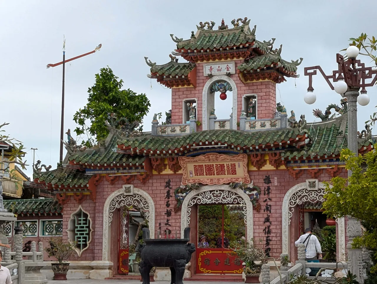
Ornate gateway with green tiled roofs at the Fujian Assembly Hall in Hoi An, Vietnam
Fujian Assembly Hall (Hoi Quan Phuoc Kien), Hoi An, Vietnam. Incidental visitors appear near the gateway. Resized and WebP-optimized. Photo: Maysam Yabandeh · Pixnio License · Original source

Dashed overview legs: not road geometry, a ferry timetable or turn-by-turn directions.

Stops in order

  1. Da Nang International Airport

    Airport reference point. Confirm the correct terminal and the bus, taxi or prebooked-transfer meeting instructions; do not use the marker as a pickup lane.

    16.043888888889, 108.19944444444 · airport reference point · Wikidata: Da Nang airport reference point (CC0 structured data)

  2. Hoi An city reference point

    City reference, not an old-town entrance, bus stop or hotel door. Da Nang airport’s guide highlights houses and assembly halls; agree an accessible return meeting place separately.

    15.877669444444445, 108.33265 · city-centre reference · Wikidata: Hoi An city reference point (CC0 structured data)

Transport choices

  1. Da Nang International Airport → Hoi An city reference point · Road

    Compare the airport-listed Hai Van bus toward Hoi An with a confirmed taxi or private transfer. Check the current service window, luggage rules and any final hotel connection; the listed bus endpoint is not this city marker. The dashed line is an overview, not a timetable, actual road or guaranteed door-to-door journey.

    Da Nang International Airport: transport from the airport · Da Nang International Airport: ancient houses and assembly halls in Hoi An

Turkey

Exchange and money · Turkish lira · TRY

Taxi preparation

Phone and arrival

Turkey

Istanbul: a historic-peninsula walk

Group Hagia Sophia, Topkapı Palace and the Grand Bazaar for a city visit. Use walking where suitable and investigate the documented T1 stations as an alternative, not taxis for every stop.

A suggested trip, not a popularity ranking. GoTürkiye documents the peninsula attractions and Grand Bazaar; the order and overview walking legs are editorial choices, not an official tour schedule.

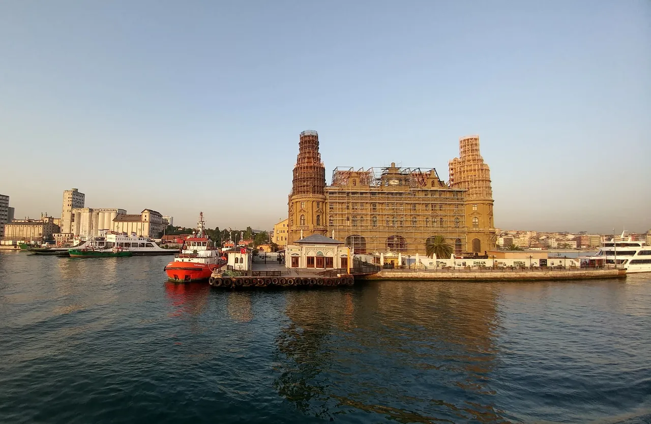
Boats and a historic waterfront building under restoration in Istanbul, Turkey
Istanbul waterfront, Turkey. The historic building is shown under restoration. Left edge cropped to remove a foreground obstruction; resized and WebP-optimized. Photo: Erkan · CC0 · Original source

Dashed overview legs: not road geometry, a ferry timetable or turn-by-turn directions.

Stops in order

  1. Hagia Sophia

    Attraction reference point, not a visitor entrance. Check current visiting arrangements before setting the day’s order.

    41.008333333333, 28.98 · attraction reference point · Wikidata Q12506: Hagia Sophia coordinate location

  2. Topkapı Palace

    Palace reference point, not a gate. Allow time for the visit itself; the T1 stop named Topkapı should not be confused with the palace.

    41.013, 28.984 · attraction reference point · Wikidata Q170495: Topkapı Palace coordinate location

  3. Grand Bazaar

    Attraction point within the bazaar area, not an exact doorway or pedestrian route. Move this visit to another outing if the museum day becomes too full.

    41.010580555556, 28.967933333333 · attraction reference point · Wikidata Q505954: Grand Bazaar coordinate location

Transport choices

  1. Hagia Sophia → Topkapı Palace · Walk

    Suggested walking connection between historic-peninsula landmarks. This is an overview line, not a verified path or entrance-to-entrance route; check local pedestrian directions and access.

    GoTürkiye: İstanbul historic peninsula destinations · Wikidata Q12506: Hagia Sophia coordinate location · Wikidata Q170495: Topkapı Palace coordinate location
  2. Topkapı Palace → Grand Bazaar · Walk

    An optional walking extension, not a required taxi leg. Metro Istanbul lists Gülhane, Sultanahmet and Beyazıt-Kapalıçarşı on T1 if you prefer to investigate transit; check stations and current service separately.

    GoTürkiye: İstanbul historic peninsula destinations · GoTürkiye: Grand Bazaar in İstanbul · Metro İstanbul: T1 Kabataş–Bağcılar tram station list · Wikidata Q170495: Topkapı Palace coordinate location · Wikidata Q505954: Grand Bazaar coordinate location

Turkey

Antalya and Side: airport, optional city, coast

Orient yourself between Antalya Airport, an optional Antalya city visit and Side. If your Side resort transfer is booked, go to the hotel first; the city is not a required detour.

An editorial coastal suggestion, not a measured popular route. GoTürkiye covers Kaleiçi and Side, and Antalya Airport documents city transit, resort transfers and regional transport towards Side-Manavgat.

Boats in Antalya harbour beside waterfront cliffs, buildings and the blue Mediterranean Sea
Antalya harbour and waterfront, Turkey. Photo by Rubel Miah, CC0, from the WordPress Photo Directory. Resized and WebP-optimized; original composition preserved. Photo: Rubel Miah · CC0 · Original source

Dashed overview legs: not road geometry, a ferry timetable or turn-by-turn directions.

Stops in order

  1. Antalya Airport

    Airport reference coordinate, not a terminal door or taxi bay. Use your booking’s actual terminal and transfer meeting point.

    36.900277777778, 30.792777777778 · airport reference point · Wikidata Q827480: Antalya Airport coordinate location

  2. Antalya city orientation point

    Representative urban coordinate, not a Kaleiçi entrance or bus stop. The city visit is optional; choose a real meeting point for any old-town outing.

    36.90812, 30.69556 · city-centre reference · Wikidata Q6487: Antalya coordinate location

  3. Side

    Urban reference point for Side, not your resort entrance. Confirm the hotel address; a Side stay does not require visiting Antalya first.

    36.766666666667, 31.388611111111 · city-centre reference · Wikidata Q152405: Side coordinate location

Transport choices

  1. Antalya Airport → Antalya city orientation point · Rail

    Optional city connection: the airport documents AntRay to the city and bus terminal, with buses as another choice. The urban marker is not a tram station; confirm the terminal, station and last walking connection. A booked Side transfer can skip this city stop.

    Fraport TAV Antalya Airport: bus, tram and resort transfers
  2. Antalya city orientation point → Side · Road

    Optional coastal extension by a separately checked transfer or regional bus/minibus connection. The airport describes Side-Manavgat regional services; confirm actual departure and arrival stops, luggage and hotel access. This is not road geometry, a direct airport-to-hotel bus promise or an economical long-taxi recommendation.

    Fraport TAV Antalya Airport: bus, tram and resort transfers · GoTürkiye: Antalya Kaleiçi and Side

China

Exchange and money · Chinese renminbi (yuan) · CNY

Taxi preparation

Phone and arrival

China

Haikou: two optional city outings

Qilou Old Streets and Wugong Temple as separate hotel-based outings. Airport/hotel transfers are already booked; no hotel point or date is assumed.

Suggested outings from documented geographic-guide destinations, not measured popularity. The connection is an overview sequence, not a required same-day taxi route.

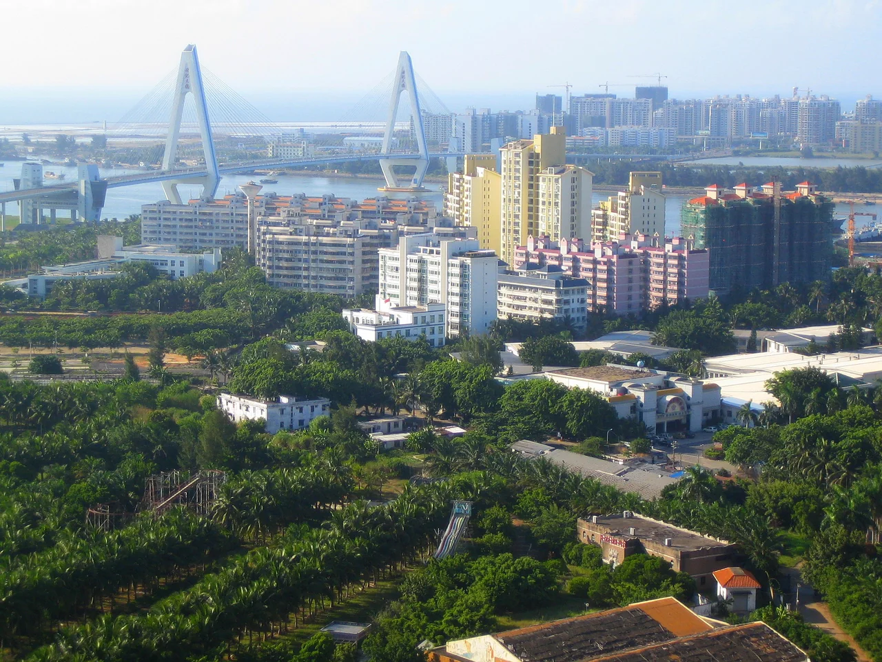
Haikou skyline and Century Bridge, photographed in 2009
Haikou skyline and Century Bridge, photographed in 2009. Photo: Anna Frodesiak · CC0 · Original source

Dashed overview legs: not road geometry, a ferry timetable or turn-by-turn directions.

Stops in order

  1. Qilou Old Streets (骑楼老街)

    Old-city streets and shops. Geographic-guide point, not a surveyed entrance; confirm the local drop-off and return pickup with the hotel.

    20.044289, 110.338006 · attraction reference point · Haikou destination points (Wikivoyage contributors; CC BY-SA 4.0)

  2. Wugong Temple (五公祠)

    The guide lists 169 Haifu Road, Qiongshan. An optional second outing; check current admission and the meeting point for the actual visit date.

    20.00943, 110.35556 · attraction reference point · Haikou destination points (Wikivoyage contributors; CC BY-SA 4.0)

Transport choices

  1. Qilou Old Streets (骑楼老街) → Wugong Temple (五公祠) · Road

    City relationship only: these can be separate outings on different days, not a compulsory direct ride. Ask the hotel about licensed taxis and return pickup; no fares, ETA or road geometry are verified.

    Haikou destination points (Wikivoyage contributors; CC BY-SA 4.0) · 巡游出租汽车经营服务管理规定

China

Beijing: Jingshan and Beihai parks

A central-city park pair: Jingshan views and Beihai’s imperial garden. Choose gates and transport locally rather than navigating along the overview line.

Both parks appear in Beijing’s official central-axis itinerary collection. This exact pair and order are our suggestion, not an official ranking or prescribed itinerary.

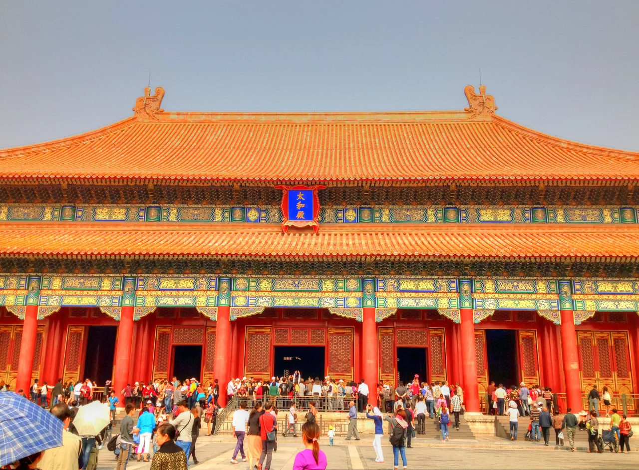
Main hall and courtyard in Beijing Forbidden City, photographed in 2013
Main hall at the Forbidden City in Beijing, photographed in 2013. Photo: Good Free Photos (source credit) · CC0 · Original source

Dashed overview legs: not road geometry, a ferry timetable or turn-by-turn directions.

Stops in order

  1. Jingshan Park (景山公园)

    Officially described for panoramic city views. Attraction point, not a pickup gate; check gate access and whether climbing suits your mobility.

    39.923611, 116.390556 · attraction reference point · Beijing Xicheng attraction points (Wikivoyage contributors; CC BY-SA 4.0)

  2. Beihai Park (北海公园)

    An imperial garden with the White Pagoda in the municipal guide. Attraction point only; confirm the usable entrance and current admission for your date.

    39.924444, 116.383056 · attraction reference point · Beijing Xicheng attraction points (Wikivoyage contributors; CC BY-SA 4.0)

Transport choices

  1. Jingshan Park (景山公园) → Beihai Park (北海公园) · Walk

    Suggested park-to-park sequence, not a checked path or accessible gate connection. Walk only if current gates and your mobility fit; otherwise arrange an ordinary taxi locally. No duration or fare is claimed.

    Beijing municipal government: central-axis and classical-garden itinerary destinations · Beijing Xicheng attraction points (Wikivoyage contributors; CC BY-SA 4.0) · 巡游出租汽车经营服务管理规定

Thailand

Exchange and money · Thai baht · THB

Taxi preparation

  • If your airport transfer is already booked, use its meeting instructions rather than setting up an unnecessary taxi account. For an independent Suvarnabhumi arrival, AOT places public-taxi counters and ticket machines on floor 1 between gates 4 and 7; confirm the vehicle and fare basis before departure.

    Suvarnabhumi Airport: Public Taxi
  • Separate a running meter, an app quote or estimate, and an agreed private transfer. AOT documents meter and agreed-price arrangements in its stated Suvarnabhumi context, with passenger-paid tolls. Ask what extras are included; do not apply Bangkok airport rules to all island services.

    Suvarnabhumi Airport: Public Taxi · Suvarnabhumi Airport: Grab designated pickup
  • AOT identifies Grab pickup at Suvarnabhumi terminal level 1, gate 4. Match the booked driver and vehicle and read the fare screen. This airport arrangement does not prove registration with your foreign number, acceptance of your card or an available island fleet.

    Suvarnabhumi Airport: Grab designated pickup
  • For Samui, Phangan or Tao, our recommendation is to ask the hotel to help arrange a ride if an app is unavailable. Confirm private or shared service, price per vehicle or passenger, luggage, waiting, return and the exact ferry pickup. Agree the cash arrangement first; a hotel-assisted fallback is a plan, not a tested guarantee.

    Suvarnabhumi Airport: Public Taxi · Lomprayah: operator-linked 2026 route timetable PDF, pages 20 and 30

Phone and arrival

Thailand

Bangkok–Ayutthaya heritage outing

A mainland visit from a Bangkok base to Ayutthaya Historical Park. Choose the places you want to see, then agree transport and the return instead of assuming a city taxi tariff covers the day.

Suggested outing, not a popularity ranking. TAT highlights exploration of historic Ayutthaya; the Bangkok start is our editorial choice. Verify attraction access and transport for your date.

Weathered brick towers and temple ruins at Wat Chaiwatthanaram in Ayutthaya, Thailand
Wat Chaiwatthanaram, Ayutthaya, Thailand. Historic brick temple ruins; restoration scaffolding is visible at the right edge. Resized and WebP-optimized. Photo: Maysam Yabandeh · Pixnio License · Original source

Dashed overview legs: not road geometry, a ferry timetable or turn-by-turn directions.

Stops in order

  1. Bangkok

    Representative city-centre point, not your hotel or a pickup. Save the actual hotel entrance and agreed departure instructions.

    13.75, 100.51666666667 · city-centre reference · Bangkok - Wikidata

  2. Ayutthaya Historical Park

    Representative attraction point, not an exact gate. Plan which heritage stops to visit, check their access and agree the return collection point.

    14.351626, 100.5575086 · attraction reference point · Ayutthaya Historical Park - Wikidata

Transport choices

  1. Bangkok → Ayutthaya Historical Park · Road

    Suggested road-transfer option, not a checked taxi price or road trace. Request a quote specifying waiting, stops, tolls and return; if considering rail, independently verify the station, service and local onward transport. No fare or journey duration is supplied.

    Tourism Authority of Thailand: Ayutthaya heritage and Ko Tao marine trip ideas, 20 May 2025 · Suvarnabhumi Airport: Public Taxi

Thailand

Samui–Phangan–Tao island sequence

A suggested Gulf-island trip using an actual operator’s published Samui–Phangan and Phangan–Tao links. Make each change only if it serves your holiday, with separate pier and hotel-transfer plans.

Suggested sequence, not measured popularity or live availability. Lomprayah’s operator-linked 2026 PDF documents both ferry links; TAT describes Ko Tao marine activities. Recheck the travel date, pier and operating conditions.

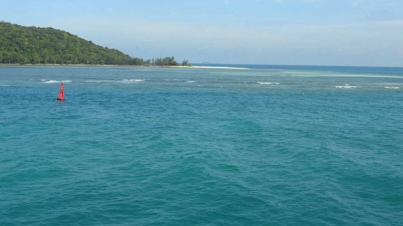
Turquoise sea and a wooded shore seen during the Samui–Phangan–Tao ferry journey
Sea view photographed aboard a Lomprayah ferry on the Koh Samui–Koh Phangan–Koh Tao route in 2019. Contextual route image, not a ferry exterior or coverage test. Resized and WebP-optimized. Photo: Fabio Achilli · CC BY 2.0 · Original source

Dashed overview legs: not road geometry, a ferry timetable or turn-by-turn directions.

Stops in order

  1. Ko Samui

    Representative island-centroid point, not a pier. The operator documentation names Pralarn, Bangrak and Nathon departures; confirm the exact pier and whether hotel pickup is included before booking land transport.

    9.5, 100.0 · island reference point · Ko Samui - Wikidata

  2. Ko Phangan

    Representative island-centroid point, not a boarding location. Verify the arrival and onward departure instructions on your own tickets; allow a flexible island stay rather than assuming every ferry connection is protected.

    9.74, 100.03 · island reference point · Ko Pha-ngan - Wikidata

  3. Ko Tao

    Representative island-centroid point, not a hotel entrance. TAT highlights diving and snorkelling around Ko Tao; check activity conditions and arrange the real pier-to-hotel pickup independently.

    10.09, 99.838 · island reference point · Ko Tao - Wikidata

Transport choices

  1. Ko Samui → Ko Phangan · Ferry

    Lomprayah’s operator-linked PDF page 30 documents Samui to Phangan from named Samui piers. This dashed overview is not a navigable sea track or current timetable. Recheck the pier, check-in instructions and any included land transfer for your date.

    Lomprayah: operator-linked 2026 route timetable PDF, pages 20 and 30 · Lomprayah: 2026 schedule documentation · Lomprayah: Terms of Service
  2. Ko Phangan → Ko Tao · Ferry

    Lomprayah’s operator-linked PDF page 20 documents Phangan to Tao. Weather can change routes and schedules; avoid an inflexible onward flight or train based only on a published arrival. No sailing availability, fare or journey duration is promised.

    Lomprayah: operator-linked 2026 route timetable PDF, pages 20 and 30 · Lomprayah: Terms of Service